NigeriaAbuja
Abuja
Administrative Region:
Federal Capital Territory
population:
2 695 000
calling code:
+234-9
postcode:
900211
900221
900231
900241-900247
900271
900281
900285-900288
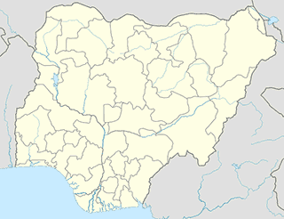
Location on the map of Nigeria
Abuja
Home goods store


Berger Paints Mini Depot
321 Road, Cornershop, Off 3rd Avenue, Gwarinpa, Abuja,Federal Capital Territory

SHEPHERD CONCEPTS
Suite B16 Shopping Mall No.8 Maputo Street Zone 3 Wuse Bissau Street, Abuja

AALIM SUPERMARKET
522 Road, Abuja
Maric Kiddies World & Household
Suite FF15 Anafara'a Plaza, 1st Avenue Gwarinpa Estate, Gwarinpa, Abuja, FCT


Thermocool Engineering Company
Shop G06, Pathfield Mall, 4th Avenue, Gwarinpa, Abuja, FCT


Eksato-Citytile Nig. Ltd
C12, Discovery Mall, Konoko Crescent & Off Ademola Adetokunbo Street, Wuse2, Abuja FCT
Lawyer


Liquor store


Everyday Wine Shop
Plot 792B, Opp. Big Bite Wuse 2, Ademola Adetokunbo Crescent, Wuse 2, Abuja, Federal Capital Territory
The Wineshop
Koro Plaza, No. 30, Adetokunbo Ademola Crescent, Wuse II, Abuja, FCT
Real 1st Wine Shop
Suite 3, Sy Plaza, Beside Danjam Plaza, 1st Avenue, Gwarimpa, Abuja, FCT

Divine Wine Shop
Suite A12, Maigari Plaza, Plot 674, Cadestral Zone, Opp. Kado Fish Market, Life Camp, Jabi, Abuja, FCT
Mosque
Car dealer

Durable Auto Nigeria Limited
Deo Gratins plaza Opp Utako Market A.E Ekuinam street, Utako


Kewalram Chanrai Group
Plot No. 234, Central Business District, Mohammadu Buhari Way, Abuja, FCT


Haier Thermocool
Opp. NNPC Filling Station, No. 3 Obasanjo Way, Zone 1, Wuse, Abuja, Federal Capital Territory


📑 Abuja all categories
AccountingAdministrative area level 1Administrative area level 2Amusement parkArt galleryAtmBakeryBankBarBeauty salonBook storeBowling alleyBus stationCafeCar dealerCar rentalCar repairCar washCemeteryChurchCity hallClothing storeColloquial areaConvenience storeCourthouseDentistDepartment storeDoctorElectricianElectronics storeEmbassyEstablishmentFinanceFire stationFloristFoodFurniture storeGas stationGeneral contractorGrocery or supermarketGymHair careHardware storeHealthHome goods storeHospitalInsurance agencyJewelry storeLaundryLawyerLibraryLiquor storeLocal government officeLocalityLodgingMeal deliveryMeal takeawayMosqueMovie theaterMuseumNatural featureNeighborhoodNight clubPainterParkParkingPet storePharmacyPhysiotherapistPlace of worshipPoint of interestPolicePost officePremiseReal estate agencyRestaurantRoofing contractorRouteSchoolShoe storeShopping mallSpaStadiumStorageStoreSupermarketSynagogueTransit stationTravel agencyUniversityVeterinary careadministrative area level 3sublocality level 1